Geoscience & Environmental

Geological modelling, geophysics, hydrogeology and environmental assessment tools for interpreting subsurface data, mapping resources and evaluating groundwater and contamination risk.


Showing 61 results in Geoscience & Environmental

Zond MT-Corrector

Zond MT-Corrector is a specialized application developed for geophysical data processing, focusing on the analysis ...

SubSurface AI

SubSurface AI applies machine learning methods to subsurface interpretation tasks. It is used to assist ...

PIX4Dsurvey & PIX4Dmatic

PIX4Dmatic is a photogrammetry engine for large drone and terrestrial image sets, producing point clouds, ...

SimaPro Craft

SimaPro is life cycle assessment software used to quantify the environmental impact of products, processes ...

Seequent Res3DInv

Res3DInv is a full-featured 3D inversion software for ERT (DC) and IP data, developed by ...

FEFLOW

FEFLOW is a finite element package for groundwater flow, mass transport and heat transport modelling. ...

midland valley Move

Move is a structural geology modelling platform used to build and validate geological interpretations. It ...

Bentley Seequent GEO-SLOPE GeoStudio

Seequent GeoStudio 2025.2 is a sophisticated suite of software designed for comprehensive geotechnical modeling, developed ...

Seequent Res2Dinv

Res2DInv is a specialized geophysical software application designed for the 2D inversion of electrical resistivity ...

Golden Software Surfer

Golden Software Surfer is a leading application designed for advanced spatial analysis, surface modeling, and ...

Virtual Surveyor

Virtual Surveyor turns drone derived orthophotos and elevation models into survey grade deliverables. The surveyor ...

Trimble Inpho UASMaster

Inpho UASMaster is a photogrammetric processing package for imagery captured by unmanned aerial systems. It ...

Trimble Inpho Photogrammetry

Inpho is a photogrammetric production suite for aerial mapping. Modules cover aerial triangulation, digital terrain ...

Geoscience Analyst Pro

Geoscience Analyst Pro 4.7.1, developed by Gocad as part of the Intrepid Geophysics company, is ...

Seequent AGS WorkBench

Aarhus Workbench is a processing and interpretation platform for near surface geophysical data, with particular ...

Seequent AGS SPIA

AGS SPIA is a versatile processing and inversion software developed by Seequent (a Bentley Subsurface ...

Lakes CALRoads View

CALRoads View is an air dispersion modelling package for roadway emissions. It provides an interface ...

Lakes AERMOD View

AERMOD View is a graphical interface for the AERMOD atmospheric dispersion model used in regulatory ...

Waterloo Hydro GeoAnalyst Plus

Hydro GeoAnalyst is an environmental data management system for groundwater and subsurface projects. It stores ...

Fullagar Geophysics VPem3D

Fullagar Geophysics VPem3D 3.4 is a specialized geophysical software package engineered for advanced 3D inversion ...

Beicip Franlab EasyTrace

EasyTrace is software for the interpretation of fracture and fault networks from images and maps. ...

DHI MIKE Zero

MIKE Zero is the common working environment for the DHI water modelling products. It provides ...

DHI MIKE HYDRO Basin

MIKE HYDRO Basin is a water resources management modelling tool for river basins. It represents ...

Bentley Seequent Volsung

Bentley Seequent Volsung 2026.1.2 is a specialized geothermal reservoir simulation software developed by Bentley Systems, ...

Schlumberger AquaChem

AquaChem is a water quality data management and analysis package for groundwater and surface water ...

GreenValley LiDAR360 Suite

LiDAR360 is a point cloud processing suite covering airborne, mobile and terrestrial lidar data. It ...

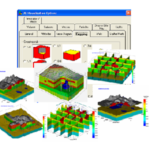
CALPUFF View

CALPUFF View is a graphical interface for the CALPUFF atmospheric dispersion modelling system. CALPUFF is ...

Catalyst Professional

Catalyst Professional is a remote sensing and photogrammetry package for processing satellite and aerial imagery. ...

IGW-Desktop

IGW-Desktop 6.0 is an advanced groundwater modeling software developed by Environmental Simulations, Inc., designed for ...

CHCNAV CoPre

CoPre is point cloud preprocessing software for mobile and airborne lidar systems. It combines trajectory ...